ggmapcn is a ggplot2 extension package for
visualizing maps of China and the world with customizable projections
and cartographic styling.
Because CRAN imposes strict size limits on package data, certain
large geospatial datasets used by ggmapcn cannot be bundled
directly. These datasets are stored externally and retrieved
automatically using check_geodata(). All high-level
functions—such as geom_mapcn() and
geom_world()—internally call check_geodata()
to ensure that required data files exist locally.
If the network is unavailable or remote mirrors cannot be reached,
check_geodata() fails gracefully by returning
NA paths. This behavior is fully compliant with CRAN’s
policy for optional network resources.
Install the development version from GitHub:
# install.packages("devtools")
devtools::install_github("Rimagination/ggmapcn", force = TRUE)check_geodata()Several datasets—such as world_countries.rda,
China_sheng.rda, and gebco_2024_China.tif—are
hosted externally.
check_geodata() automatically:
local_dirsextdata directorytools::R_user_dir("ggmapcn", "data")NA instead of errors when mirrors cannot be
reachedTo check and retrieve all files:
check_geodata()To retrieve explicitly the datasets used by
geom_world():
check_geodata(c(
  "world_countries.rda",
  "world_coastlines.rda",
  "world_boundaries.rda"
))
If your network cannot access cdn.jsdelivr.net or
raw.githubusercontent.com, you may manually download the
files and place them in a directory passed to
local_dirs.
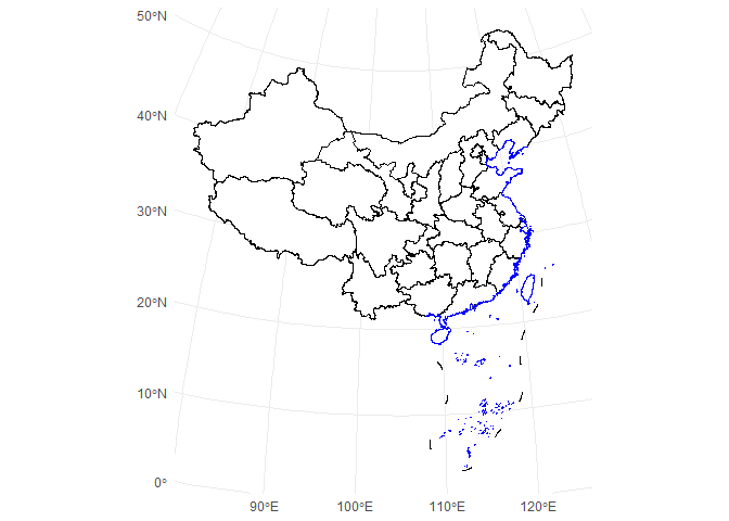
library(ggplot2)
library(ggmapcn)

ggplot() +
  geom_mapcn() +
  geom_boundary_cn() +
  theme_minimal()
ggplot() +
  geom_mapcn(
    crs = "+proj=aea +lat_1=25 +lat_2=47 +lat_0=0 +lon_0=105 +datum=WGS84",
    fill = "white",
    color = "black",
    size = 0.7
  ) +
  geom_boundary_cn() +
  theme_bw()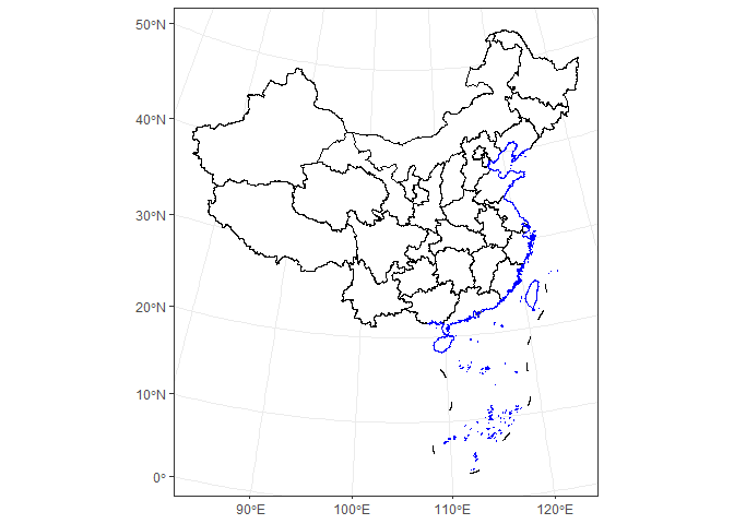
ggplot() +
  geom_mapcn(fill = NA) +
  geom_boundary_cn(
    mainland_color = "black",
    mainland_size = 0.5,
    coastline_color = "skyblue",
    coastline_size = 0.5
  ) +
  theme_bw()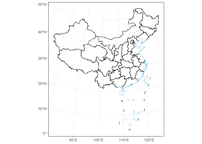
ggplot() +
  geom_buffer_cn(mainland_dist = 40000) +
  geom_buffer_cn(mainland_dist = 20000, fill = "#BBB3D8") +
  geom_mapcn(fill = "white") +
  geom_boundary_cn() +
  theme_bw()
#> Warning: attribute variables are assumed to be spatially constant throughout
#> all geometries
#> Warning: attribute variables are assumed to be spatially constant throughout
#> all geometries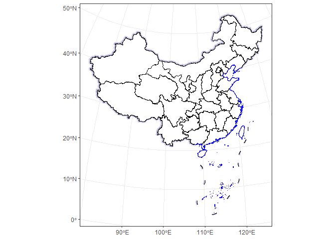
ggplot() +
  geom_world(show_ocean = FALSE) +
  theme_bw()
#> Warning: geom_world() has been redesigned; its interface and defaults have
#> changed compared to earlier development versions. See ?geom_world for details.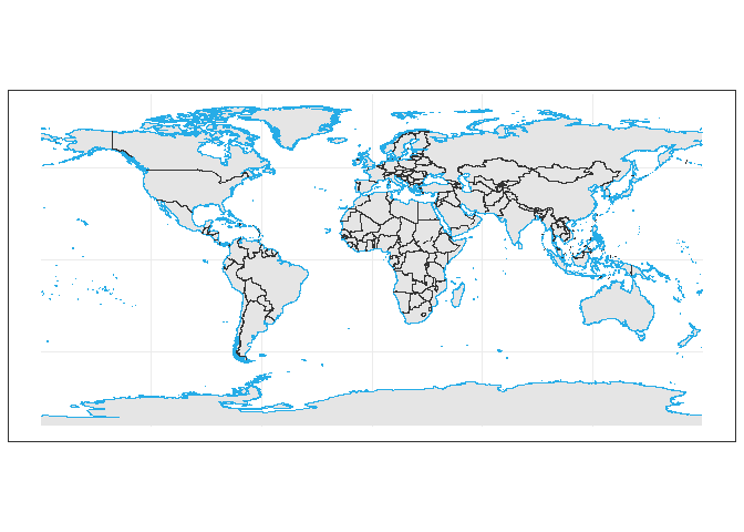
Provided by Tianditu
https://cloudcenter.tianditu.gov.cn/administrativeDivision/
Province-, prefecture-, and county-level boundaries are preprocessed
and simplified for efficient rendering in ggplot2.
The global dataset (countries, coastlines, and political boundaries) is curated and maintained by the package authors. It is optimized for consistent cartographic outputs across world projections and supports antimeridian splitting.
See the Articles for tutorials on: